La Cerdanya Cycling Tour

La Cerdanya Cycling Tour

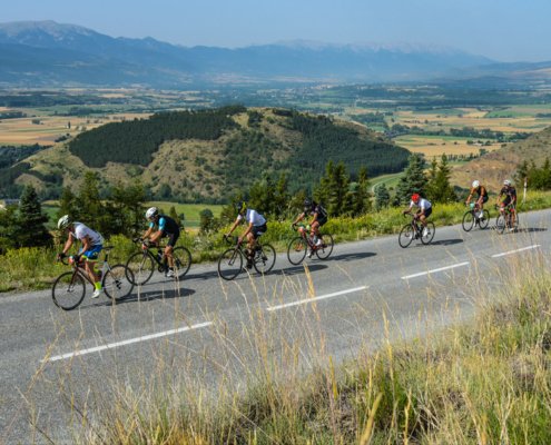
The Cerdanya Cycling Tour is held every year from the town of Alp. This race has three routes, one of 86 km, one of 141 km, and the most demanding of 182 km. Here we tell you more about the 182 km Endurance Race, but on the website you will find information on the 3 routes.

The 182 km Endurance race is designed for cyclists who want to experience one of the great cycling routes in the Pyrenees. This demanding and beautiful tour goes through some of the best mountain passes in the upper and lower Cerdanya.

Data sheet:

Kilometers: 182 km

Elevation gain: 3,514 m

Maximum altitude: 1,886 m (Coll de la Llose)

Minimum altitude: 1,010 m (Bellver de Cerdanya)

Maximum slope: 19.2%

Average slope: 3.8%

Map and altimetry


La Cerdanya Cycle Tour

La Cerdanya Cycling Tour Race


Rutes

July 19, 2020

Download the Route Track


Download the Route Track


Puigcerdà – Toses – La Molina – Puigcerdà

Puigcerdà – Toses – La Molina – Puigcerdà

Classic cycling route in La Cerdanya.

We leave Puigcerdà and head along the N-260 towards Ripoll going up the mythical Collada de Toses and before reaching Planoles, we move towards Dòrria and Toses and go back up towards La Molina. Then we go to Masella and go down to Das to return to Puigcerdà passing by Urtx and Queixans.


Data sheet:

Kilometers: 80.2 km

Elevation gain: 1,473 m

Maximum altitude: 1,811 m (La Molina)

Minimum altitude: 1,091 m (Queixans)

Maximum slope: 13.1%

Average slope: 3.7%


Puigcerdà - Toses - La Molina - Puigcerdà

Map and altimetry


Climb to Puigmal

Climb to Puigmal

This is a hard climb that takes us very close to the mythical peak of Puigmal.

We leave Sant Martí d’Aravó and go to France crossing the border in Puigcerdà. We head towards Santa Llocaia and take the road in the direction of the old Puigmal ski resort and until we reach the end of the paved road at 2,283 m. We descend along the same road towards Err and from there we will go to Sallagosa and Llívia and return to the starting point through Càldegas.


Data sheet:

Kilometers: 58.3 km

Elevation gain: 1,334 m

Maximum altitude: 2,283 m (Puigmal)

Minimum altitude: 1,128 m (Bourg-Madame)

Maximum slope: 25.6%

Average slope: 4.3%


Pujada al Puigmal

Map and altimetry


Tour around the Lower Cerdanya

Tour around the Lower Cerdanya

This is a classic lap for Cerdanya cyclists whose legs cannot stand big cumulative gains.

We leave Puigcerdà on the N260 in the direction of La Seu d’Urgell, on a gentle descent we will reach Martinet and once there we have the steepest section of the route going up to Montellà and from there by a road to Santa Eugènia de Nerellà. Passing by Pi, we return to Bellver and take the “baga” road passing by Prats and then taking direction to Sanavastre and Soriguerola, we will return by the old road to Puigcerdà.


Data sheet:

Kilometers: 54 km

Elevation gain: 605 m

Maximum altitude: 1,154 m (Montellà)

Minimum altitude: 955 m (Martinet)

Maximum slope: 10.9%

Average slope: 2.5%


Volta per la Baixa Cerdanya

Map and altimetry


Tour around the Cerdanya valley

Tour around the Cerdanya valley

This is a tour of the upper and lower Cerdanya.

We start in Alp and head to Puigcerdà passing by Soriguerola and the old road. Once in Puigcerdà we take the Llívia road and from there we start to climb from Estavar to the top of Fon-Romeu. We continue uphill until we get close to Montlluís to Bolquera and cross the valley to go to Eina. We will take a very nice road that will take us to Sallagosa. From there we will take the road from Llívia to Puigcerdà and we will go on a slight descent from Puigcerdà towards Bellver by the N-260. Once in Bellver we will return to Alp passing by Prats.


Data sheet:

Kilometers: 87.4 km

Elevation gain: 1,091 m

Maximum altitude: 1,851 m (Font Romeu)

Minimum altitude: 1,018 m (Bellver de Cerdanya)

Maximum slope: 10.1%

Average slope: 2.7%


Volta per la vall de la Cerdanya

Map and altimetry


Carlit

Carlit

This pyramidal-shaped mountain is the highest watchtower in the Cerdanya and the Eastern Pyrenees. This mountain, surrounded by ponds and lush vegetation, is also the most crowded in the whole Cerdanya region, especially in summer.


Technical Data


Access: From Montlluís we follow the D-118 towards La Llagona until we find, on the left, the detour of the D-60 that goes up to the Bollosa lake.

Home: La Bollosa car park.

Difficulty: Easy- Medium

Maximum altitude: 2,921 m

Elevation gain: 900m

Total duration: 4.45 h (2.30 h one way / 2.15 h return)

Time of year: Spring, summer and autumn. In winter it is a difficult route.

Notes: In the final section you will have to climb (I +) some rocks with good climbing holds. The D-60 road is closed in winter in “Pla dels Avellans”. In summer it has restricted traffic during the months of July and August you will need to get on a bus to start the route.

Route


Located next to the Bones Hores hotel car park, take the path that starts on your left (signs). We enter the forest and pass an area of granite blocks. Later, the path turns to the right and, following some very marked landmarks, we reach the Viver lake (30 min), which is located on the right. (30 min), which is located on the right.

The path continues through a wetland and passes by the Sec and Comassa lakes. Immediately we go up a small ridge that takes us to a plain from which we see the Carlit. After this plain we make a small descent and we will stop near the Vallell lake (2,143 m, 1 h).

At this key point, we cross the drain of this pond by a walkway and turn left (W). Now we have to go over some rocky steps, surrounded by grass. The path takes us to a small pass and then to the beginning of a plain, from where the Carlit seems very close. We cross an area of reddish rocks that come off the Tossal Colomer and, overcoming a steep climb, we come out to the Gelat de Subirà lake, the highest in La Cerdanya (2,598 m, 1.50 h).

We are located at the base of Carlit. We turn left and with a small climb we get to the “Collomer” pass. We walk towards the eastern edge of the mountain following a few zigzags along the way and cross a small ridge until we reach a pass, marked with a large landmark. Then we climb some parts with good climbing holds. Then, a diagonal trek and a climb on broken ground lead us directly to the mountain.

From there we just have to turn left and reach, without further difficulty, the summit of Carlit (2,921 m, 2.30 h). Exceptional panorama of the surrounding mountains and the reservoirs of Lanós and La Bollosa. The view arrives untik Canigó and Maladeta mountains.

Map and altimetry

Carlit

Camí de Sant Marc

Camí de Sant Marc

This walk will take us, through a flat and pleasant itinerary, from Puigcerdà to the hermitage of Sant Marc, located within the municipality of this town. Then we will go to the banks of the Segre and return to Puigcerdà by the path that comes from Les Pereres.


Camí de Sant Marc

Technical Data


Access: We park the vehicle in a designated area next to the 4 Camins park, and head to the Sant Marc Industrial Zone and the beginning of the Age road (signs).

Start: Car park next to the 4 Camins park and the Sant Marc Industrial Zone.

Difficulty: Very easy.

Maximum altitude: 1,200 m

Slope: imperceptible

Total duration: 1.45 h

Time of year: All year round.

Notes: Recommended route for the whole family.

Route


At the beginning of the road to Age, a sign on the road on the right tells us: “Camí de Sant Mark”.

This is where the itinerary really begins. The road, completely flat and now paved, clearly takes a southerly direction. We begin to walk calmly following the straight line that traces these wide paths. We are surrounded on both sides by a row of trees that will accompany us at all times and we see ashes, alders, poplars, etc. This route, about 900 m, will take us to the square in front of the hermitage of Sant Marc. From here we can see, making a 360º turn, the mountain ranges that surround La Cerdanya: Puigpedrós, Carlit, Puigmal, Tosa d’Alp, Moixeró and Cadí.

To supplement this walk, we will continue along the local paved road that passes next to the hermitage and that, westbound, continues between meadows; finally, it is close to the Sant Marc golf course. We must take the first detour to the left and continue south along a beautiful promenade, now unpaved, crowded with trees on each side. After leaving the Mas d’en Prat on the left of the road, it continues through meadows and trees until a small descent leads us to touch the river Segre, which we cross through an original bridge.

We are at a crossroads where the signs indicate the direction to Queixans, on the right, or to Puigcerdà (4.3 km) on the left, which we will follow. In this direction, the road takes us again, for a distance of about 300 meters, to the paved road. We take it in the same direction until we find the wide bridge, suitable for vehicles, which crosses the river again and, continuing to the north, leads us again to the golf course and the hermitage of Sant Marc, from from where we will return, by the already known path, to the starting point.

Map and altimetry

Camí de Sant Marc

Camí dels Enamorats de Puigcerdà

Camí dels Enamorats de Puigcerdà – Rigolisa

This is a very frequent route that is carried out mainly from the edges of the Puigcerdà lake. Its route, surrounded by trees and with good views of La Cerdanya, follows the network of Trails of Cerdanya and a section of the ditch that transports the water to the lake.


Camí dels Enamorats de Puigcerdà

Technical Data


Access: We head to Puigcerdà and head to Plaça d’en Dionís Puig, north of the lake.

Start: Plaça d’en Dionís Puig

Difficulty: Very easy.

Maximum altitude: 1,230 m

Slope: imperceptible

Total duration: From 45 minutes to 1 hour.

Time of year: All year round.

Notes: The length of this walk is 3.5 km if we take the direct route along the Paseo dels Enamorats, and 4.1 km if we take the Rigolisa detour. Recommended for the whole family, on foot or by bike.

Route


Located in Plaça d’en Dionis Puig, in the north-eastern part of the Puigcerdà lake, we follow the signs on the Senders de Cerdanya signs that mark the direction of the Camí d’Ur (route 221). So, we take the direction of this road (north), and we leave to the right the building of Villa San Antonio, which is within the itinerary of the Ruiz Zafón Literary Route in Puigcerdà. We soon leave the last houses of the town and head towards the building of the Hospital Transfronterer de Cerdanya.

After this hospital, the views of the mountains to the north of La Cerdanya, Puigpedrós, Coll Roig, Pic dels Moros, etc., are spectacular. The paved road continues until it reaches a crossroads where we find the ditch and more signposts. In this place we have to turn right and take the route marked with the number 222, with the name of “El Camí dels Enamorats” (1.6 km). This route follows a section of the ditch and is very beautiful, especially in autumn, as it is completely surrounded by trees, which give it a very idyllic flair.

Halfway through the “camí dels Enamorats”, we can follow this path, or if we want, we can turn left to take another unpaved track, which takes us to the square where there’s the church of Sant Jaume de Rigolisa, with a neo-Gothic chapel consisting of three parts: a crypt under the presbytery, the chapel itself, and a square bell tower 17 m high.

We leave this place behind and take, to the west, a wide promenade, surrounded by populated areas, with a route that leads us again to the end of the “Camí dels Enamorats”, in this case, at the southern entrance. From here, we follow the “passeig de Rigolisa”, again with the ditch on our right and, protected by the wide structure of the wall that guarded the old prison of Puigcerdà. Then we arrive again at Ruiz Zafón Literary Route and the starting point.

Map and altimetry

Camí dels Enamorats de Puigcerdà

Tour around the Bollosa lakes

Tour around the Bollosa lakes

The local path of the PR 8 follows in its entirety the route of the five lakes that are located below the Bollosa reservoir. This is a beautiful and simple itinerary that will take us to know one of the most beautiful lakes in La Cerdanya: La Pradella.


Circuit pels estanys de la Bollosa

Technical Data


Access: From Montlluís we follow the D-118 towards La Llaguna until we find, on the left, the detour of the D-60 that goes up to the Pla dels Avellans and the Bollosa lake.

Start: Car park at Pla dels Avellans

Difficulty: Easy

Maximum altitude: 2,005 m

Elevation gain: 300 m

Total duration: 3.10 h

Time of year: All year round.

Notes: The D-60 road is cut in winter at “Pla dels Avellans” which, for this reason, is the starting point of this route. In summer, the D-60 has restricted traffic during the months of July and August and you’ll need to take a bus to go there.

Route


From the car park where the barrier is (1,740 m), we head south along the track that leads to Pla dels Avellans. After crossing a bridge we leave in the middle of the plain, where we turn north to look for the chairlift. Behind it is the start of the route (signs).

We enter the forest and follow the path, which immediately turns west. We start to gain height following the yellow paint marks and we climb the last slope, which goes up through a birch forest, until we come out to a forest track, with more indicators. These indicate the direction of La Bollosa (GR 10). So, we turn right and, on flatter ground, we advance through a small forest. Then the path goes up more rocky sections until, finally, we reach a small pass behind which appears the large lake of La Pradella (1,960 m, 55 min).

To the right of the lake we see the path of PR 8, which we must follow. So, we continue along this path, which for a while follows the bank of the Pradella and then over a hill and down to the Estany Negre, located in a shadier place (1,947 m, 1.10 h). Now the path continues to the left of this lake until it reaches its western end. From here we start a steep climb, between large rocks, and climb relentlessly to the “Llarg” Lake, which is sunk to the right.

After this lake, we will have to follow a grassy ditch that takes us to the shallow Racó lake. We leave it behind to cross a stretch of forest, turn left and go out onto a plain where we find La Bolloseta (2 h), rather a fen. The road continues to the west, below the Bollosa dam, and will look for the GR 10 again. When it reaches the “pla de Bones Hores”, it finally turns south and takes us back to the Pradella lake and “pla dels Avellans” (3.10 am).

Map and altimetry

Circuit pels estanys de la Bollosa

Angostrina Valley

Angostrina Valley

The Angostrina valley connects La Cerdanya with the Carlit mountain range. For this reason, it is used as a passageway for livestock that, from Llívia, goes up to graze in the Bollosa sector, taking advantage of the grazing rights of the farmers of this town.


Vall d’Angostrina

Technical Data


Access: From Puigcerdà we head for Angostrina. After passing this town and before crossing the river of the same name, we immediately find a detour with signs on the left that leads to this valley. We take it and go up the road, initially paved, which takes us to the car park in front of the hermitage of Sant Martí d’Envalls.

Start: Parking in front of the hermitage of Sant Martí d’Envalls.

Difficulty: Easy

Maximum altitude: 2,017 m

Elevation gain: 475 m

Total duration: 5.15 h (2.45 h one way + 2.30 h return).

Time of year: All year round.

Notes: The road that goes up from the Angostrina detour to the Sant Martí d’Envalls car park is closed during the summer months at the height of a previously enabled car park, which increases this route by half an hour.

Route


From the car park we cross a barrier with yellow signs. We head north along a shady stretch until we reach the rest area next to the hermitage of Sant Martí d’Envalls. After the hermitage, the path climbs a rocky stretch with small streams of water. At the end of this climb we come out on a sunny plateau with some dry stone walls, where the valley widens for good. We follow the signs of the “Tour du Carlit” and arrive at a small water dam. We cross it and climb a hill from where we see the Puig del Cap de l’Home in front of us. After passing through a flat grass area, we enter a forest of black pine and hazelnut trees. The marks take us to the small “Bridge of Empedrats”, which serves us to cross the Angostrina river again (1 h). The path now climbs the east side of the Puig del Cap de l’Home. As we walk we leave this hill behind and cross another flat area, where the path is surrounded by provence broom bushes and blackberries.

We patiently walk through the bushes towards the ski lifts of the Font-Romeu ski resort, which we see in the distance on the right. Later, the path we follow leads us to a wide area, covered with grass. We pass these area on the left to avoid some wetlands and arrive at the beautiful lake of La Pradella, with a refuge next to it (1,960 m, 2.15 h).

After contemplating this lake, we have two options to arrive at La Bollosa. The first, easier, is to turn a little to the left to take the wide track that leads directly to the reservoir. The second, more beautiful, is to continue along the GR-10 path that comes right next to the refuge and that, walking through a black pine forest with alpenroses, also reaches the Bollosa lake (2,017 m, 2.45 h).

Map and altimetry

Vall d’Angostrina