Vall de Llo

Vall de Llo

This interesting excursion will allow us to cross the beautiful gorges formed by the river Segre at its beginning. If we want to reach the source of this river, we must continue the walk towards the Finestrelles pass and branch off, before reaching it, towards the Fonts del Segre.


Cerdanya, la Gran Vall dels Pirineus

Technical Data


Access: Take the N-116 towards Sallagosa. In this town we turn right to take the road that leads to Llo. Before entering this town we find a detour to the right that leads to the car park of Banys de Llo, where we will leave the vehicle.

Home: Llo Baths car park.

Difficulty: Easy

Maximum altitude: 1,834 m

Elevation gain: 450 m

Total duration: 3.15 h (1.45 h one way + 1.30 h return).

Time of year: All year round. In winter it is highly recommended to do a snowshoeing hike to the Culassa refuge.

Note: Currently, the access to the Llo valley is closed to vehicles at its very beginning, at the height of the via ferrata of Les Escadilles.

Route


We start walking under the suspended bridge that leads to the beginning of the via ferrata of Les Escadilles. Leaving this road on the left, we continue along the paved road for a stretch in which we also have the Segre river on the left. Soon we see the impressive south wall of the hill of Sant Feliu de Castellvell and the first narrow bends that form the gorges of the Segre. Later, the road crosses a small bridge from which the river is located on the right. Surrounded by slender and impressive walls, and admiring the beautiful shapes of the river, we reach the end of the road, where we find a last bridge, the detour to Mas Patiràs and some signs (35 min).

This is where the start of the unpaved forest trail begins. We follow it until we reach a metal fence and a Canadian pass for cattle (1,604 m). We continue along the track to the south. The river now descends to our left. The route of the track is gaining height at first and then flat path until river. We cross a beautiful black pine wood and continue along the track to the south. The river now descends to our left. The route of the track is gaining height at first and then flat path until river. We cross a beautiful black pine wood and continue along the track. On the left stands the Serra dels Clots, which separates us from the Vall d’Eina. The route of the track is gradually gaining height, and the river is now sunk to the east. We follow it, always to the south, until in the background, a little to the left, we can already see the Culassa refuge.

Finally we reach the last bridge of the route. Here we leave the fork that continues to the right and ascends, in a sharp curve, to the Pla de la Creu. We, however, have to cross this bridge, turn left and head to the vicinity of the visible Culassa refuge (1,834 m, 1.45 h). Some landmarks located at the top of the meadow in front of the refuge indicate the beginning of the path that leads to the Fonts del Segre and the Coll de Finestrelles.

Map and altimetry

Vall de Llo

Cavalls del Vent

Cavalls del Vent

The Cavalls del Vent crossing is a circular mountain route that connects the different guarded refuges of the Cadí-Moixeró Natural Park. The route passes through the regions of La Cerdanya and Berguedà.

The itinerary can be easily divided into a number of stages appropriate to the level of each one. You will cover a total of 84.20 km and you will overcome a total cumulative gain of about 5,600 m. During the trek you will pass near several peaks that offer us a great view of the Natural Park and the whole Pyrenees: Comabona (2,554 m), Penyes Altes del Moixeró (2,279 m), La Tosa (2,537 m) … and you will discover some beautiful places, such as the Pas dels Gosolans, the north face of Pedraforca, the Camí dels Empedrats, the Prats d’Aguiló, Moixa mountain range or Coll de Jou.

The route continues through lush red pine and black pine forests, in the lower parts of the route, and through open areas with alpine meadows, in the upper parts. During the trek you will enjoy the magnificent views of the horizon offered by the panoramic ridges and the spectacular karst terrain where the water slips into the depths of the mountain, dissolving the soft limestone rock.


Web: www.trekking.cavallsdelvent.com

Phone: 938 215 111

Email: reserves@cavallsdelvent.com

Tracks de Cerdanya

Tracks de Cerdanya

A different and fun way to get to know La Cerdanya valley by mountain bike. With the convenience of luggage transport and the peace of mind of an organization that makes sure everything goes perfectly. The routes can be done from May to October, last between 2 and 5 days and you can choose different distances and styles of mountain biking.

Web: www.tracksdecerdanya.com

Phone: 669 426 248

Email: info@tracksdecerdanya.com

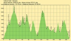
Tour around Cadí Moixeró

Tour around Cadí Moixeró

Bicycle route through a high circular mountain, in 5 stages, between the regions of Alt Urgell and Cerdanya, with the river Segre as a link. Itinerary with a demanding route, designed for expeerienced cyclists and in good physical shape.

Modalities: Trinxat (298km) or Express (190km)

Web: inforutes.parcolimpic.cat

Phone: 973 360 092

Email: parcolimpic@parcolimpic.cat

Volta Cadí Moixeró

Camí dels Bons Homes MTB

Camí dels Bons Homes MTB

If you have chosen the mountain bike mode to cover the “Camí dels Bons Homes”, think that it is a great personal challenge where you will discover a fantastic country, but at the same time you need important physical preparation and planning of all stages, taking great care of the places where you will have to rest, if necessary by making reservations in advance.

Also think that you will be circulating in the Pyrenees, which we will cross from south to north or vice versa; this means that large slopes must be overcome and that the weather must also be taken into account. In winter it is unthinkable to be able to do it in its entirety and in autumn the rains can damage the roads.

To make the mountain bike route you must keep in mind that the route does not always follow the GR 107 , marked with white and red markings. There are alternative tracks for bicycles that are not signposted on the ground, but that are described and referenced on the website. Most of the French stages match with the footpath.

Usually when there is a track and a path, the bikes always go by the track (look at the map of the brochure, where it indicates the options for MTB and horse-riding), and the route on foot that normally goes though paths.

We recommend visiting the website, where you will find the maps, description, altitudes, tracks of the stages, etc.

Web: www.camidelsbonshomes.com

Phone: 93 824 77 00/654 125 696

Email: info@camidelsbonshomes.com


Route of the Hidden Lakes

Route of the Hidden Lakes

With the Route of the Hidden Lakes you can discover much of the Cerdanya and part of Andorra, going from refuge to refuge over five stages. The great attraction of this itinerary is to discover the forty lakes that can be seen along the way. This is a long circular route that allows many modes, as the paths are well signposted and the stages pass between one refuge and another, so there are checkpoints on the route that allow you to easily follow the route or be able to communicate any unforeseen.


Web: https://sites.google.com/view/routedhidden lakes

Phone: 973 36 06 67

Email: rutadelsestanysamagats@gmail.com

Ruta dels Estanys Amagats

Camí dels Bons Homes

Camí dels Bons Homes

The Camí dels Bons Homes is a trans-Pyrenean tourist route of approximately 200km that goes from the Sanctuary of Queralt (Berga-Catalonia) to Foix (Ariège-France). This itinerary commemorates the exile of the Occitan Cathars, otherwise called “bons homes i bones dones” (good men and women), who promoted pure and simple Christianity, based on spirituality and against the authoritarian, corrupt and ostentatious 13th century Catholic Church.

Currently converted into a Long Distance Trail ( GR-107). You can also discover by car the villages where “Bons homes” lived, touring the regions of Berguedà , Cerdanya , Alt Urgell and Arieja .

Individually or in an organized way, you can discover enchanting landscapes by listening to the murmur of history, with a range of services such as a specific information office, accommodation, mountain guides, luggage transport, travel agencies and taxis.


Web: www.camidelsbonshomes.com

Phone: 93 824 77 00

Email: info@camidelsbonshomes.com

Cavalls del Vent MTB

Cavalls del Vent MTB

Cavalls del Vent MTB is a route that will allow you to discover the surroundings of the Cadí-Moixeró Natural Park. You will enjoy the spectacular walls of the southern face of the Moixeró, you will travel the southern face of Cadí mountain range, enjoying magnificent views of the eastern and northern sides of the Pedraforca, moving from valley to valley along tracks and paths at high altitudes. Later, you will cycle along the spectacular northern side of Cadí with its steep walls, narrow valleys and magnificent corners.

You can visit towns such as Bellver de Cerdanya and Talló or other towns in neighboring regions such as La Seu d’Urgell, Josa de Cadí, Tuixent, Arsèguel, El Querforadat and Bagà.
In terms of cultural heritage, we highlight the Sanctuary of Santa Maria de Talló and the Cathedral of Santa Maria d’Urgell in La Seu d’Urgell, the only entirely Romanesque cathedral in Catalonia, both declared cultural assets of national interest.

In the accommodation of the Cavalls del Vent you can enjoy the gastronomy of Pyrenean regions and the calm and comfort necessary to face the next stage to the fullest.

A route full of contrasts and surprises for lovers of nature, mountain biking and great treks.

Web: https://www.cavallsdelvent.com/ca/mtb/

Phone: 93 821 51 11

Email: reserves@cavallsdelvent.com


Cadí Challenge

Cadí Challenge

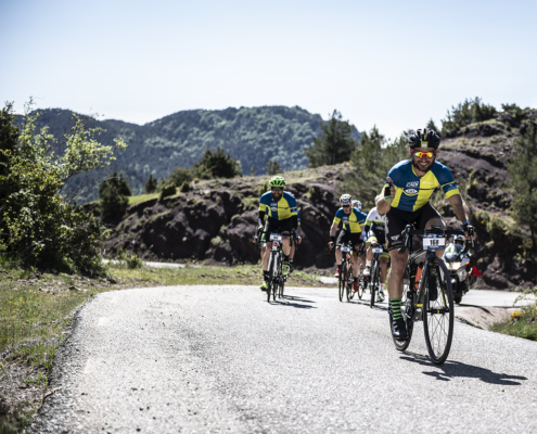
The Cadí Challenge is the complete tour around Cadí Moixeró Natural Park by road bike. It runs along the best-kept roads of La Cerdanya, Berguedà and Alt Urgell. The highest point of the crossing is “Coll de la Creueta” mountain pass at 1,929m. More than 80% of the route is within the Natural Park, so we ask for the maximum respect for the environment.

Together with this tour, a race is organized on the first weekend of June. It is a new concept of cycling tour divided into 2 stages, with a maximum of 200 participants, ideal for connecting with other people who are motivated by unique experiences like this. More than a cycling tour, it is a journey of discovery that will keep a special place in your memory.

Data sheet:

Kilometers: 217 km

Elevation gain: 8,782 m

Maximum altitude: 1929 m (Coll de la Creueta)

Minimum altitude: 704 m (Alas)

Maximum slope: 26.2%

Average slope: 4.6%


Map and altimetry


Cadí Challenge

Cadí Challenge Race


Cadí Challenge

29 i 30 agost 2020

Download the Route Track


3 Nations

3 Nations

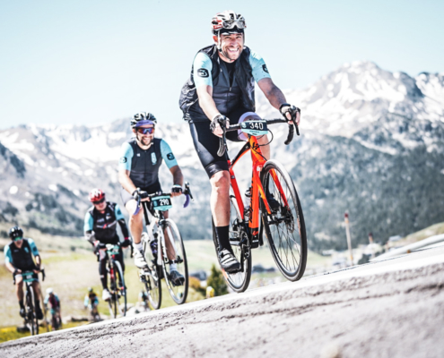
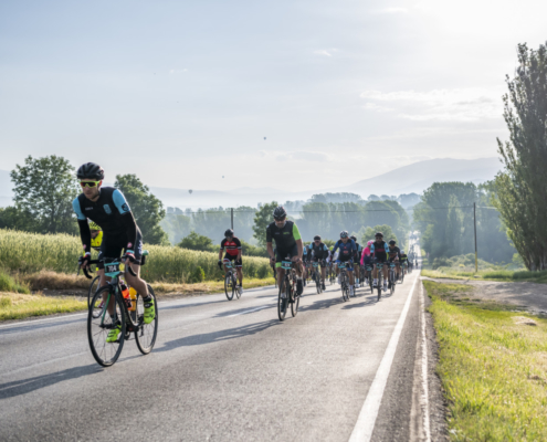
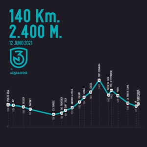
Departing from Puigcerdà, the 3 Nations Race is the only one in the world that crosses three countries, giving a distinctive touch to each of them. We will travel through the Catalan Pyrenees, the French Pyrenees, and Andorra, passing through mythical and well-known mountain passes such as the Port d’Envalira, with a elevation gain of 2,407 meters, being the highest paved mountain pass in Europe. All these characteristics make it a unique tour: three countries, 140 kilometers through the legendary mountain passes of world cycling.

The 3 Nations cycling tour is a classic in the Catalan racing calendar with 40 years old. The race is held every June and Puigcerdà becomes for one day the capital of Catalan cycling.

Data sheet:

Kilometers: 140 km

Elevation gain: 2,400 m

Maximum altitude: 2407 m (Port d’Envalira)

Minimum altitude: 700 m (La Seu d’Urgell)

Maximum slope: 16.2%

Average slope: 3.4%


Map and altimetry


3 Nacions

3 Nations Race


3 Nacions

June 12, 2021

Download the Route Track