Campcardós Valley

Campcardós Valley

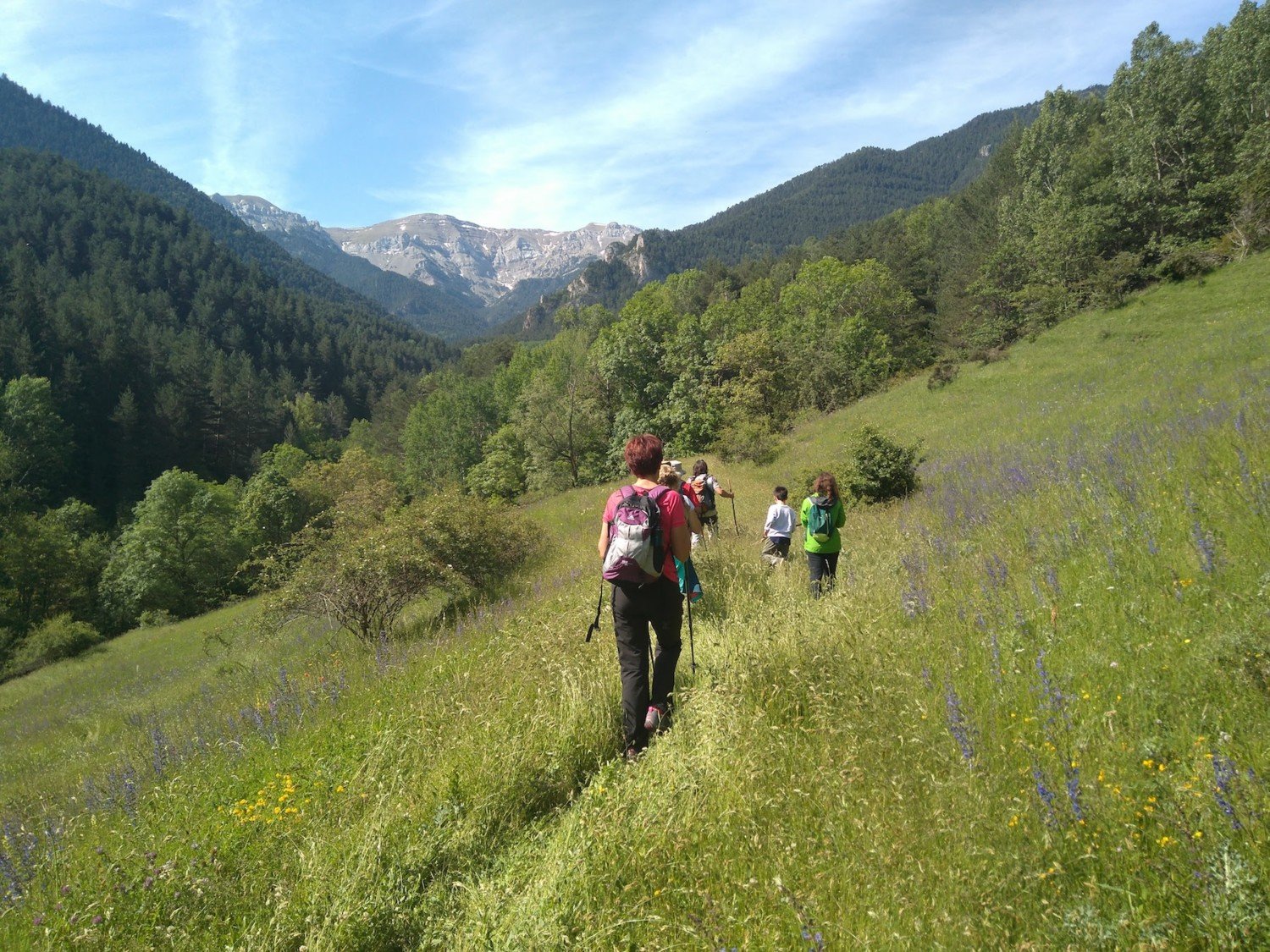
This valley, closed to the west by the Portella Blanca of Andorra, is protected from the north winds by the mountain range that forms the Picos de Fontfreda, Font Negra and Envalira. The slender silhouettes of Pedraforca and Roc Colom will accompany us throughout the route.


Vall de Campcardós

Technical Data


Access: Located in the municipality of Porta (N-20), turn left and cross the bridge that passes under the train track. We find a paved track and follow it to the left, south, to find a small bridge that crosses the river. There is a small car park where vehicles must be parked.

Start:Car park next to Querol river.

Difficulty: Easy

Maximum altitude: 2,076 m

Elevation gain: 566 m

Total duration: 3.15 h (1.45 h departure + 1.30 h return).

Time of year: All year round.

Notes: This route can be done all year round, but it is especially interesting to do it in winter, when the weather conditions are not favorable in other places, as we move through a fairly safe area, sheltered from the wind and no possible loss.

Route


From the car park next to Querol river we take, wetbound, the paved track that begins to go up the valley and reaches a repeater. From here the unpaved track begins. We make every effort to go up the first section of the route, the steepest, bounded by beautiful dry stone walls.

At the end of this climb we come to some cattle fences, from which the path already glides and the valley widens more and more (30 min). From here we already have the first views of Roc Colom and Pedraforca. From time to time, we see on the rocks the white and red marks of the GR 7 trail, which comes from Andorra, and the GR 107 trail, which comes from the Llosa valley. We continue along the valley next to Campcardós river, which descends to the left.

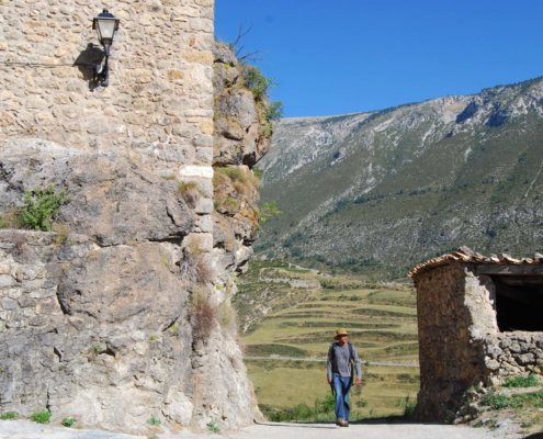
As we walk we come across several huts, small in size, made by shepherds, with stone walls and grass-covered. A flatter section leads us to an ascent, perfectly paved, which we climb without difficulty. When you reach the top of this climb, the silhouette of the refuge appears, located to the left of the road. We follow the wide path and reach this refuge (1,950 m, 1.15 h). The track is transformed into a path and the path goes up first through an area of meadows, which in summer are occupied by cattle. After these parts we enter a not so beautiful part, covered with provence broom shrubs. By a steep area we head to the bottom of the valley and we are approaching the course of Campcardós river. After a short while, we cross the river by some stones and arrive at “Petit” lake, and after passing some hills covered with blackberry, at the “Gros” lake (2,076 m, 1.45 h). From the lakes you could continue to the Portella Blanca of Andorra.

Map and altimetry

Vall de Campcardós

Ridolaina Valley

Ridolaina Valley

You can access Prat d’Aguiló by a track from Montellà, but the most recommended walking option is to acces from Nas, following the “Ruta dels Segadors” through the Ridolaina valley. Known as La Cerdanya road, it was used by the groups of reapers from Gòsol, who rented farmhouses in La Cerdanya. In the summer of 1906, the painter Pablo Ruiz Picasso also used this route.


Vall de Ridolaina

Technical Data


Access: From Bellver de Cerdanya, take the local road to Pi. Then continue to the right on another road to Nas. Cars have to be parked at the entrance of the village.

Home: Nas.

Difficulty: Easy

Maximum altitude: 2,040 m

Elevation gain: 815 m

Total duration: 5.30 h (3 h one way + 2.30 h return).

Time of year: Second half of spring, summer and the first two months of autumn.

Notes: In winter it is a route suitable for snowshoeing.

Route


From Nas (1,225 m) follow a track marled the yellow-white stripes of the PR C-124. Cross ” Pla de Nas” and leave a shortcut to the right that climbs the “Collet” (1,360 m, 20 min). Here it connects with the track. On the plains of “Hereus”, on the other side, the ruins of the tower of “Sant Romà”, a medieval fortification, can be seen falling from the valley. Further up, take another shortcut to the right that crosses a canal and connects again with the track in front of the Tosca fountain. A few steps to the right, along the track, you reach the spring of the Cortal de l’Oriol (1,560 m, 1 h 15 min). Above it is a meadow with a shepherds’ refuge. Without leaving the track, go down to La Baga, where the track gains altitude. You cross the Abeurador torrent and, going arounf a buttress, you cross the Eres torrent. A little further up there is a detour to the left (1,640 m, 1 h 45 min) which must be taken. Leave the main track and go up following a secondary track. Not much later, you have to leave it on a path, also on the left, which runs very close to the Eras river, but which does not cross it. The slope increases, but it is pleasant thanks to the panorama of the northern side of Cadí. After a while you reach a meadow surrounded by the woods and find a forest track that passes by a metal hut. The slope is moderate and this track connects with the one that goes from Montellà to Prat d’Aguiló to the Coll de l’Home Mort (1,850 m, 2 h 30 min).

Continue along the track to the left, where a shortcut also on the left leads very close to car park at the end of the track. The same track leads to the guarded refuge of Prat d’Aguiló (2,040 m, 3 h). From this meadow, a walk from the northern side of Cadí, the whole Ridolaina valley is seen from above.

Map and altimetry

Vall de Ridolaina

Magic mountains

Magic mountains

Muntanyes Màgiques is a challenge for hiking and Catalan Pyrenees lovers: 5 stages to go from Ribes de Freser (Ripollès) to Estana (Cerdanya), 17 peaks, 98.47 km. and 15,113 m. of cumulated gain. A hard but amazing route. You just have to walk and enjoy. Magic Mountains takes care of the rest.


Web: www.muntanyesmagiques.com

Phone: 93 821 51 11

Email: info@muntanyesmagiques.com

The Other Side of the Fork

The Other Side of the Gallows

Route of historical, cultural and landscape interest whose track passes through the Cadí-Moixeró Natural Park.

The route begins a walk to the impressive north face of the Cadí, in La Cerdanya, and it is needed to move towards Berguedà through “pas dels Gosolans”, an old pass that connected both regions, and that takes us to the land of the imposing Pedraforca.

This route allows us to discover the Vansa Valley, where we will intensely enjoy small mountain villages and their people who still keep alive the conservation of the rural heritage of their valley.

Finally we walk down to the plain of Alt Urgell, a green valley rich in crops, with the Segre river and surrounded by mountains. We then arrive to civilization at La Seu d’Urgell.


Cadí High Route

Cadí High Route

This is a circular and self-guided route (there is also a guided option) that runs through the Cadí-Moixeró mountain range.

Along 7 stages, 88.5 kilometers and 7300 meters of cumulative gain, you walk along the mountain range and climb 5 of its peaks: La Tosa, Penyes Altes del Moixeró, Comabona, Pic de Costa Cabirolera and the mythical Pedraforca . The starting point is Can Cerdanyola. Cars are parked there and we move towards the “Sant Jordi” refuge.

Other refuges on the trip are: El Niu de l’Àliga, Prat d’Aguiló, in Molí de Gósol, Lluís Estasen and Vents del Cadí, the latter is the last refuge in the route, where the final prize is collected.


Web: www.laaltaruta.com

Phone: 679 191 847

Email: info@laaltaruta.com